![Equal Earth World Map Poster - map design shows continents at true relative size - LAMINATED, 18” x 29” [Light Blue]](https://m.media-amazon.com/images/I/91c3gNHjXZL.jpg)


🌐 Own the world, exactly as it is.
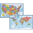
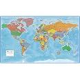
The Equal Earth World Map Poster is a large 18” x 29” laminated map featuring continents displayed at their true relative sizes. Designed with heavy-duty lamination for tear resistance and durability, it boasts a sleek satin finish and is proudly made in the USA, making it a stylish and lasting addition to any professional or home environment.
| Manufacturer | Palace Learning |
| Brand | Palace Learning |
| Item Weight | 3.52 ounces |
| Product Dimensions | 18 x 29 x 0.04 inches |
| Color | Light Blue |
| Sheet Size | 18 x 29 inches |
| Paper Finish | Satin |
| Manufacturer Part Number | 1-EE-LIGHTBLUE-WORLD |
P**T
Great map
Best detailed world map I could find for a great price. Laminated. The size is perfect for my wall.
S**C
Lots of information in attractive format
I'm very pleasantly surprised at the quality of this map! I decided it's time to have more than a vague idea of where stories in the news are taking place, and this map will help me do that and a lot more.The printing is very precise and even my old eyes can read the labels without a magnifying glass, which is impressive. (Not from far away, but I was expecting to need a magnifier to read it close up.) Each country is a different color than its neighbors, plus boundaries are clearly marked. Each national capital is marked and named. I particularly like that this is an "equal" map showing actual relative sizes of areas -- Africa is getting its due.The clear lamination layers are well made, no flaws, scratches, cracks, or cloudy places. The map arrived rolled up and has a soft curl at first. I had no trouble attaching it flat to a wall on the first day, and it's flattening out very quickly when I take it off the wall -- the slight curl will be gone after a week.There are thoughtful "bonuses" that I really like. Areas that are "disputed or self-proclaimed state" have a light grey crosshatching, which will help keep me from getting confused as things change. Each corner of the map has a larger "blowup" version of an area of the world -- Northeast United States (basically the US East Coast); Central and Eastern Europe; Eastern Mediterranean; and Eastern Caribbean. Island nations, such as Polynesia and Micronesia, are outlined and labeled, with smaller island groups within them also identified (Marshall Islands, Solomon Islands, etc.). For areas that are controlled by another country, that country is identified in parentheses (i.e. Pitcairn Islands (UK)). Below the map, flags of 195 countries are shown in alphabetical order.It took me a long time to decide whether to get the Blue version or Yellow version of this map, and I went with blue. To my delight, the map is two-sided -- Blue on one side, Yellow on the other!If you're looking for an information-packed map that is also Art On The Wall, and sturdy enough to last for years, this is it. I'm going to do a lot better at answering geography questions on Jeopardy in the future!
A**S
a good point of discussion in parties
The design is visually appealing and accurately represents the continents and countries. The vibrant colors and clear details make it a perfect addition to any room, whether for educational purposes or as a decorative piece. The quality of the paper is excellent, and it looks great framed or unframed. Highly recommend for anyone looking for a beautiful and informative world map poster
P**B
A Very Nice, Perfectly-Sized, Differently-Sided Map of Earth
I like this map. It’s not so huge that you can’t find a place to display it, nor is it so small that you can’t read anything on it. The map is printed on both sides, one is the blue that you see on the sales site and the other is in an older (tan) style that still preserves all of the information. I like how it is an equal area map that is designed to show the different areas and countries of the world in comparable sizes.I found the map very difficult to straighten out. It wanted to curve back into its original tube form no matter how long I pressed it under a rug, or reverse rolled it. I finally had to do what the instructions suggested and heated it with a hair dryer. That fixed it!Along the bottom of the map are representations of the different countries of the world with their names. I don’t know if it’s all the countries that recognize themselves or countries recognized by the U.N. or whatever, but it’s a start in learning how varied our world is!
X**N
Great Map of the World--heavily laminated for durability
If you like maps you are going to really love this one. The projection helps one understand the relative sizes of the continents. For example, Africa seems much larger on this map than on many other maps you may have seen. It is impossible to provide a perfect representation of a round earth on a flat map, but this one makes a really positive effort.A really nice feature is the corners are used for an enlargement of certain areas which are not easily viewed in the full projection. For example the NE United States is quite small on the main map, but on the enlargement the states and cities are more easily discerned.While it takes a bit of coaxing to flatten after being shipped rolled, the map has a very nice lamination which will allow one to use dry erase markers to write on it for educational purposes. If the lamination is left intact, this map will last well beyond the current national borders shown.A bonus is the same map in an aged tint is available on the reverse.
A**.
Almost too sturdy
This map is absolutely perfect and came laminated.My one problem it's that it's too sturdy. I put it on my wall with a thumbtack on each side. after about 2 seconds, each side pulled towards the center and ripped through the poster.It's so sturdy in the shape of its roll that it rolled up when I put it up!!!If you get this and use thumbtacks be aware and use at least 2 thumbtacks on each corner.
D**E
have scissors handy to remove from plastic wrap
nice quality.... after patiently unwrapping it-- It was unnecessarily challenging to get the map out of a plastic wrap, because we tried to open it by hand. Tip: Don't scrunch the wrapping down along the tube or you'll regret how difficult it will be to extract the map. It would have been a breeze with scissors handy and slicing the plastic wrap lengthwise.Lamination is lightweight, so it's protected but not too thick to insert thumbtack flags.We use as a go-to reference to see where in-the-world current affairs are taking place.Two-sides have different color tones would make it suitable for different preferences or room decor.
Trustpilot
2 months ago
2 months ago
![Equal Earth World Map Poster - map design shows continents at true relative size - LAMINATED, 18” x 29” [Light Blue]](https://images-na.ssl-images-amazon.com/images/I/91c3gNHjXZL._AC_UL116_SR116,116_.jpg)