


🌍 Survey Smarter, Measure Faster, Lead the Field!
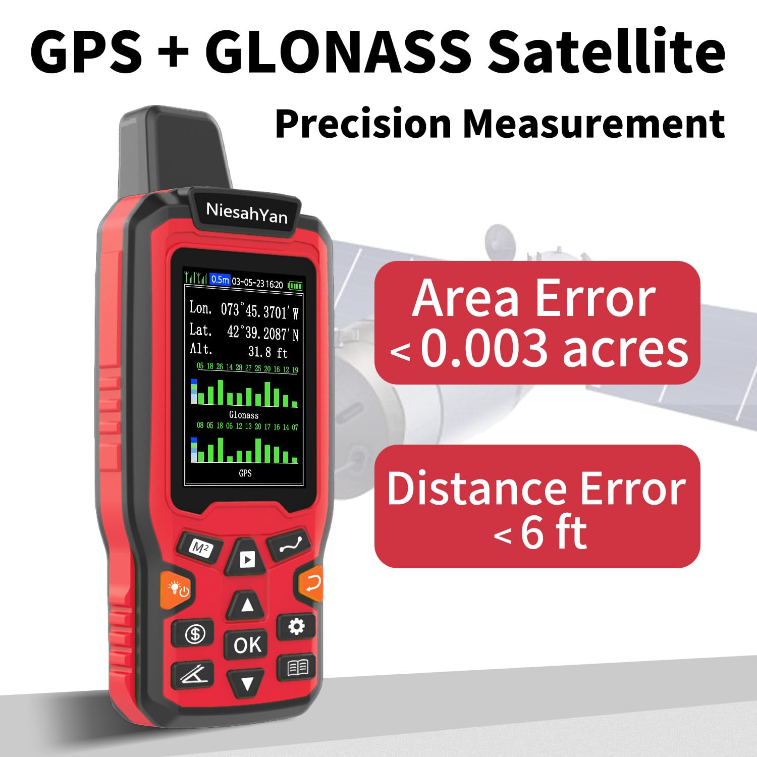
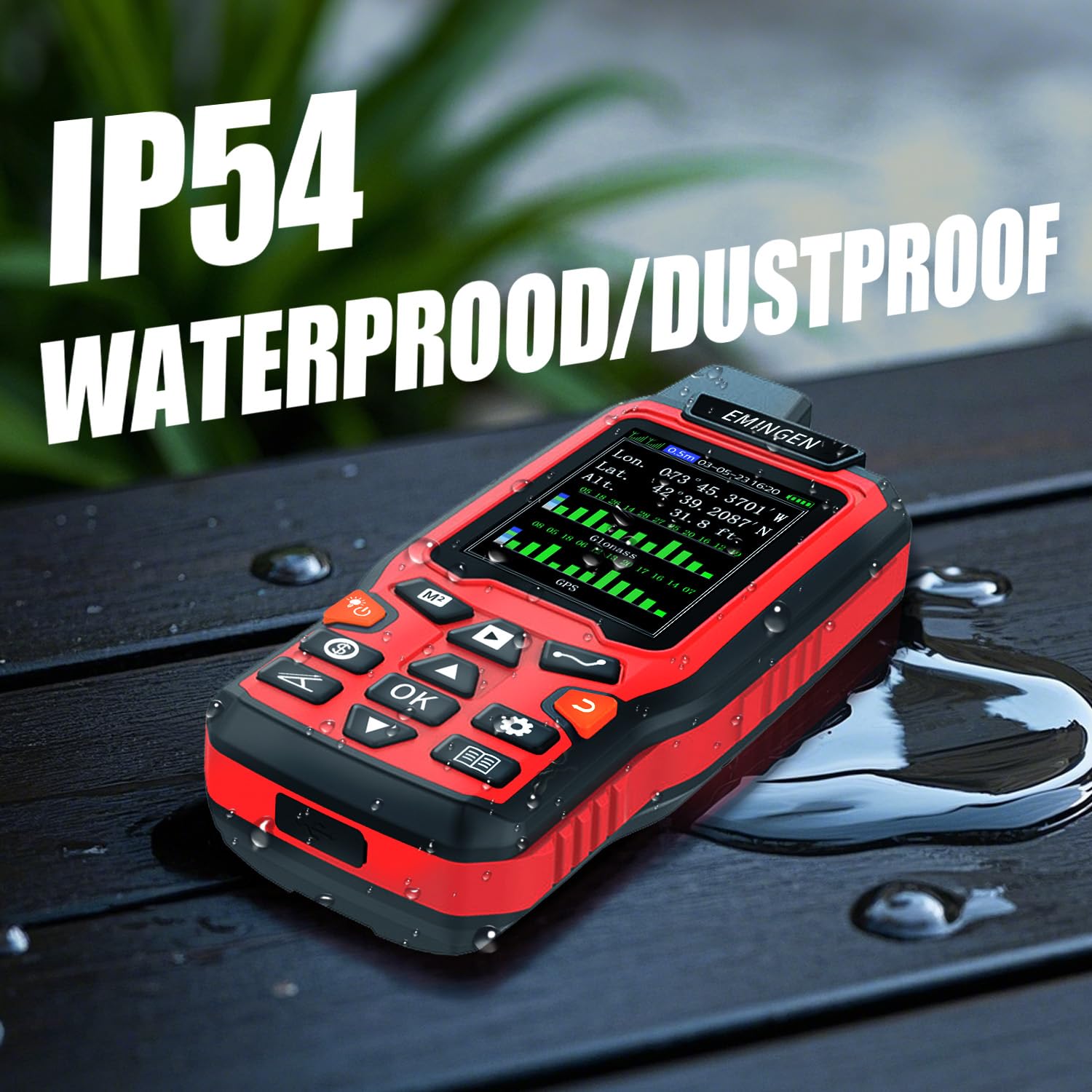
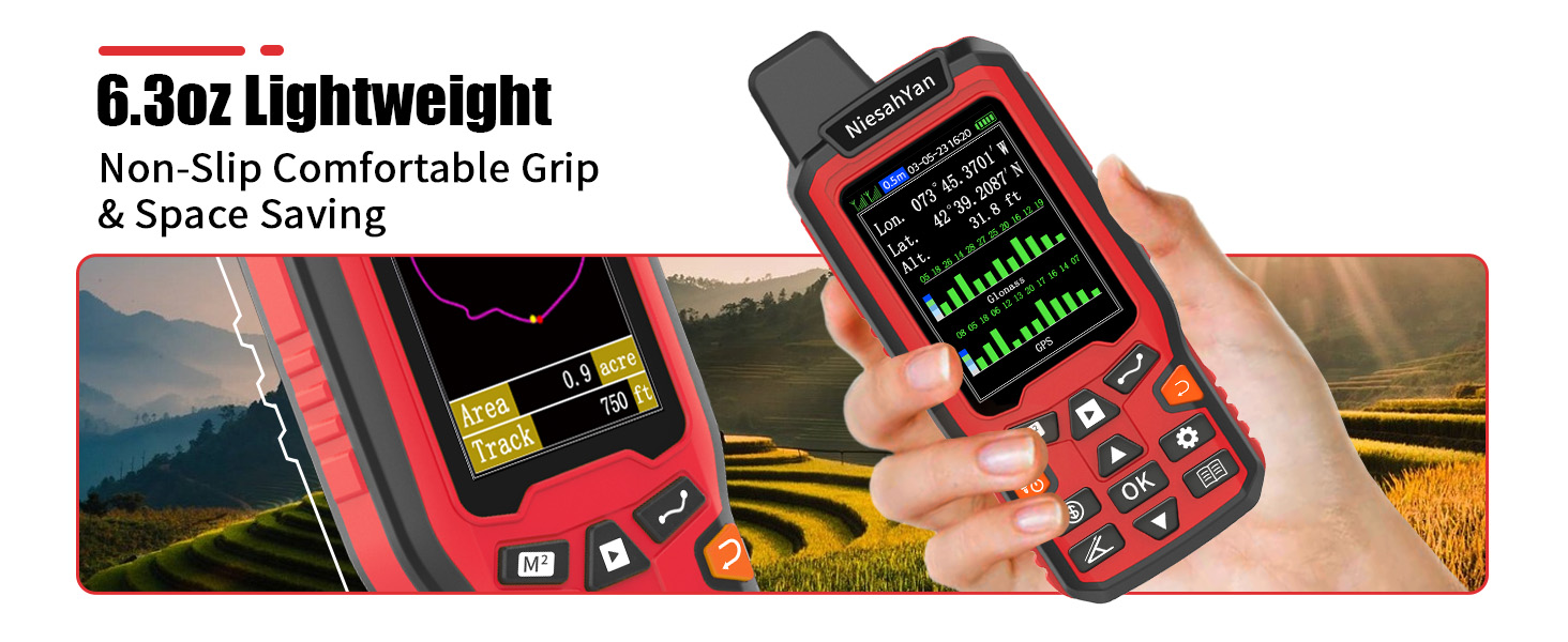
The NiesahYan ZL180 is a rugged handheld GPS device engineered for professional-grade land surveying and area measurement. Featuring dual GPS and GLONASS satellite support, it achieves an impressive 0.003-acre accuracy. Its 2.4-inch backlit LCD provides clear, real-time data, while its lightweight, ergonomic design ensures comfort during extended use. Ideal for ranches, farms, gardens, and parking areas, this device offers versatile 4-in-1 measurement modes tailored for outdoor precision. Note: optimized for open-air use and not intended for waypoint saving or navigation.

| Compatible with | Personal Computer |
| Display Size | 2.4 Inches |
| Display Type | LCD |
| Power Source | Battery Powered |
| Features | Waterproof |
| Sport | Camping & Hiking |
| Map Type | Topographic |
| Included Components | USB cable, instruction manual, portable rope |
| Batteries Included? | Yes |
| Brand | NiesahYan |
| Manufacturer | NiesahYan |
| Item model number | ZL180 |
| Product Dimensions | 13.97 x 5.84 x 2.79 cm; 308 g |
| ASIN | B0DKWTVP17 |
Trustpilot
2 weeks ago
1 month ago